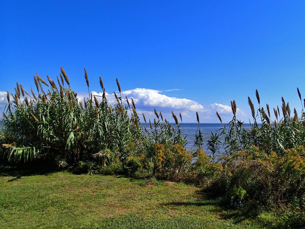
Scene of Mobile Bay as viewed from along the Mobile Bayfront Trail.
Mobile Bayfront Trail
Mobile, Alabama
3.6 miles long according to the shown trail location on a City of Mobile map.
(58% unmarked roads, 39% unmarked trail, 3% unmarked shoulder.)
Rating: 1 (out of 10). Too short. Mostly unmarked roads.
0 road/driveway crossings. Can't get any lower than that.
0 people encountered using the trail. Can't get any lower than that.
Pros: Not a single driveway or road crossing to contend with. Bathrooms at Doyle Park. Flat Grade. Short length. Adequate parking. Picnic Tables at both ends of the trail. Open shelter at McNally Park to get out of the rain. Maintained trail so there is no ducking or weaving due to shrubs. Smooth asphalt surface. No curbs to jump. Low traffic on roads. Low traffic on the trail. Trail relatively litter free. Nice scenic views of Mobile Bay, Perch Creek and Brookley Airport.
Cons: Over half the bicycle "trail" is on plain unmarked roads which you could find in any neighborhood. That is a misrepresentation City of Mobile mapping. Poorly placed vehicle barriers on the trail leads to dangerous single lane bottle necks. A better option would have been to place a vehicle barrier post in the middle of the path and the rest of the posts on each side allowing trail users to safely pass each other. 3 sharp turns made worse by vegetation along fence blocking view. No map at trail heads. Litter seen on the ground at the City of Mobile parks. Only one fading mark on trail so out of town visitors could easily get lost. No water fountains. Due to weeds and grass growing into the edge of the trail asphalt, the once 10 foot wide asphalt is reduced by a foot in some areas putting the trail width below the recommended 10 feet width for multi-use trails.
Viewpoint: In a nutshell, yes, I will ride this trail again but only because I live nearby. The very flat 3.6 mile trail should be easily conquered by most people. With no driveway or road crossings more time can be spent enjoying the scenery instead of dealing with vehicle traffic. Planes taking off and landing can be viewed at Doyle Park. McNally Park offers fishing opportunities in Mobile Bay or Perch Creek. The trail provides good opportunity for families to bicycle in relative safety. Top off the day with a picnic at either trail head (park). Bicyclists who like to ride on multi-use trails won't get much satisfaction from the mere 1.4 miles of paved trail on this ride. Riding at 15 mph, they'll be finished with the trail in less than 6 minutes - not very attractive to out of town visitors. However, if you're traveling around the South Side of Mobile on bicycle, riding the Mobile Bayfront Trail sure beats riding on the heavily traveled Dauphin Island Parkway.
The downloadable GPS track of the Mobile Bayfront Trail along more photos can be found here:
http://www.everytrail.com/view_trip.php?trip_id=2383065
Click on any thumbnail below to bring up a larger view photo gallery with commentary.
 RSS Feed
