Mobile's Downtown Tour Designated Bike Route
http://www.mobileunited.org/images/trails/Downtown.pdf
8.0 miles long.
Unmarked Narrow Asphalt and Concrete Roads
Rating: 1 (out of 10)
109 road/driveway crossings (1-Way). On average that is about 13 intersections per mile which is high.
4 People encountered (Both Ways). On average that means encountering 1 person along the trail for every 3 miles traveled which is very very low, but to be expected because the trail is basically neighborhood streets.
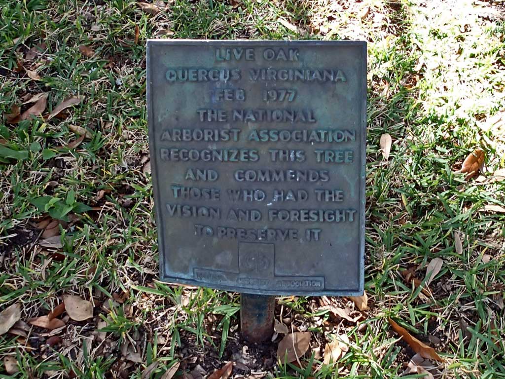
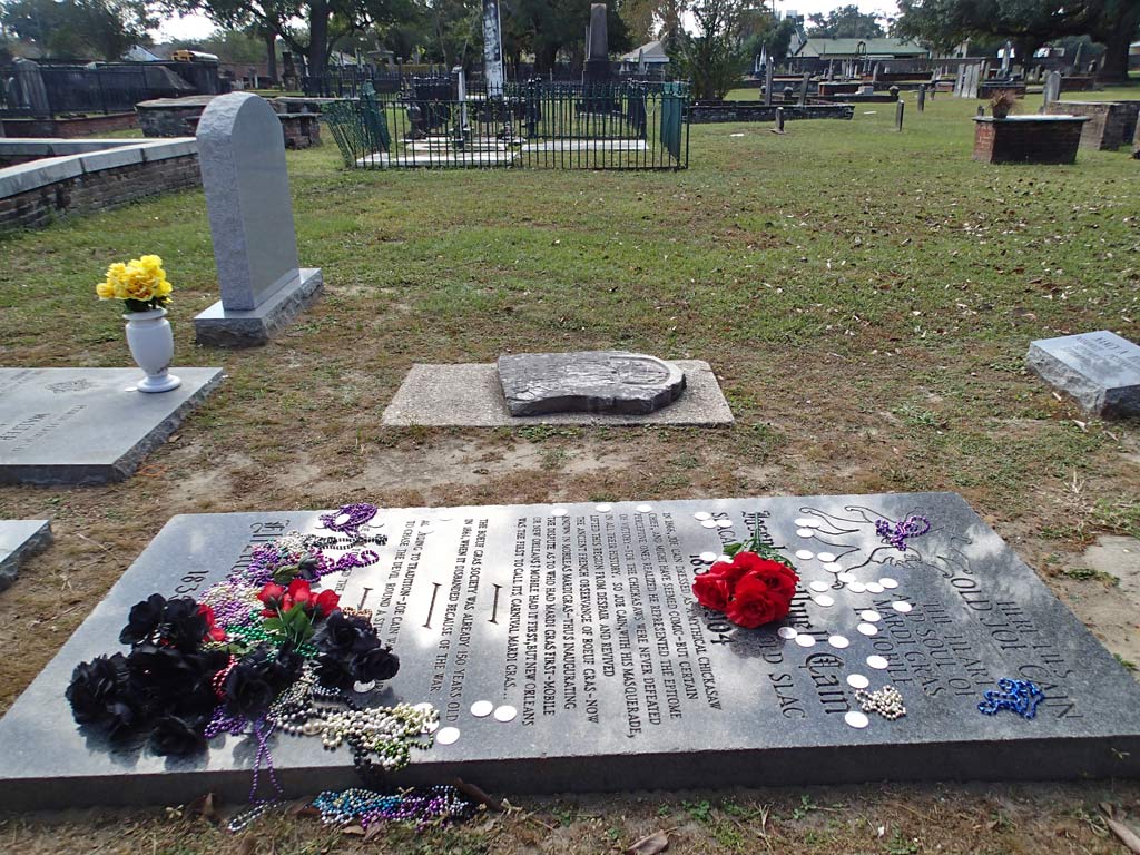
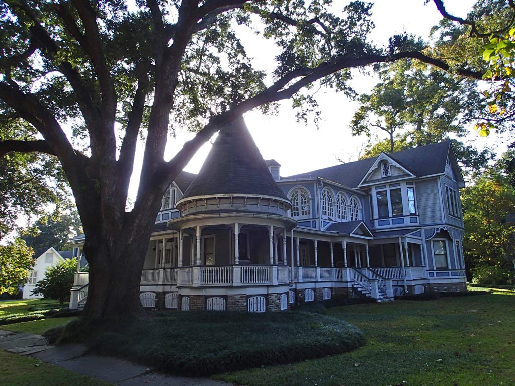
Pros: The route follows mostly low traffic downtown neighborhood roads. There are bathrooms along the trail like at the Library, Arby's, Fort Conde and Bienville Square. The bike route grade is flat. Parking can be found near both ends of the bike route at Springdale Mall and Fort Conde. The scenery varies from shotgun houses to nice well maintained mansions. There is a nice oak tree to see on Caroline Avenue.
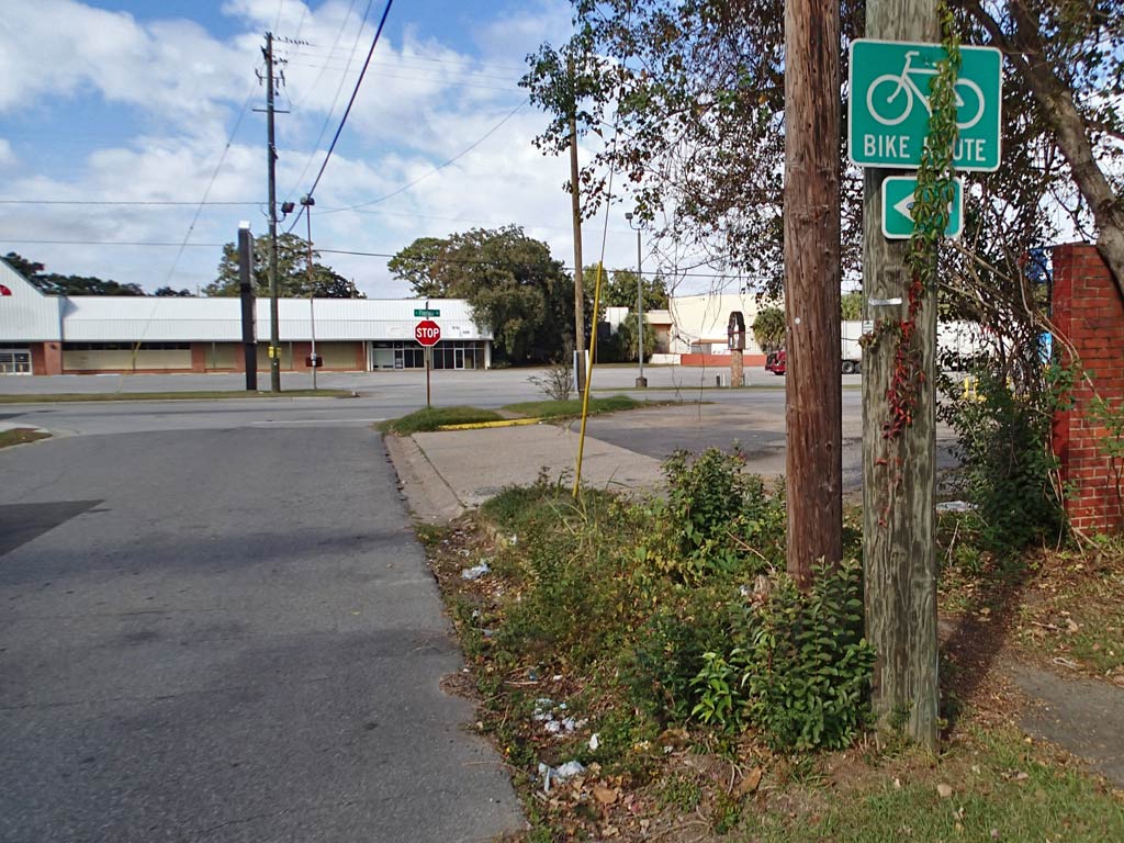
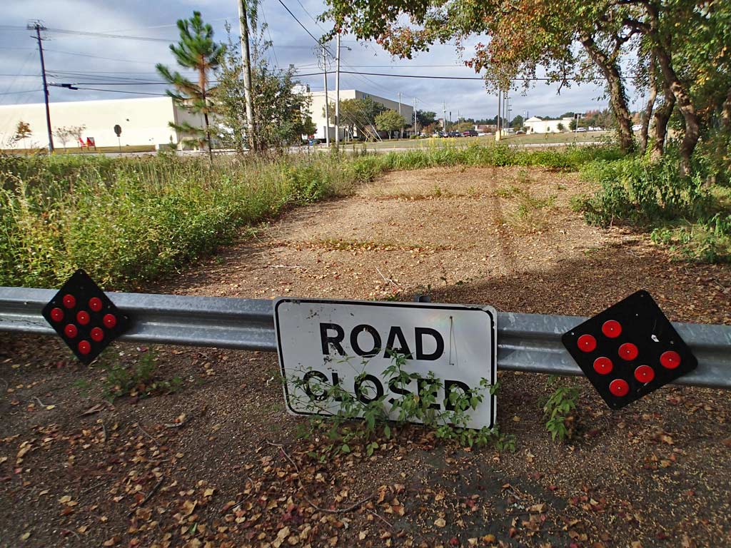
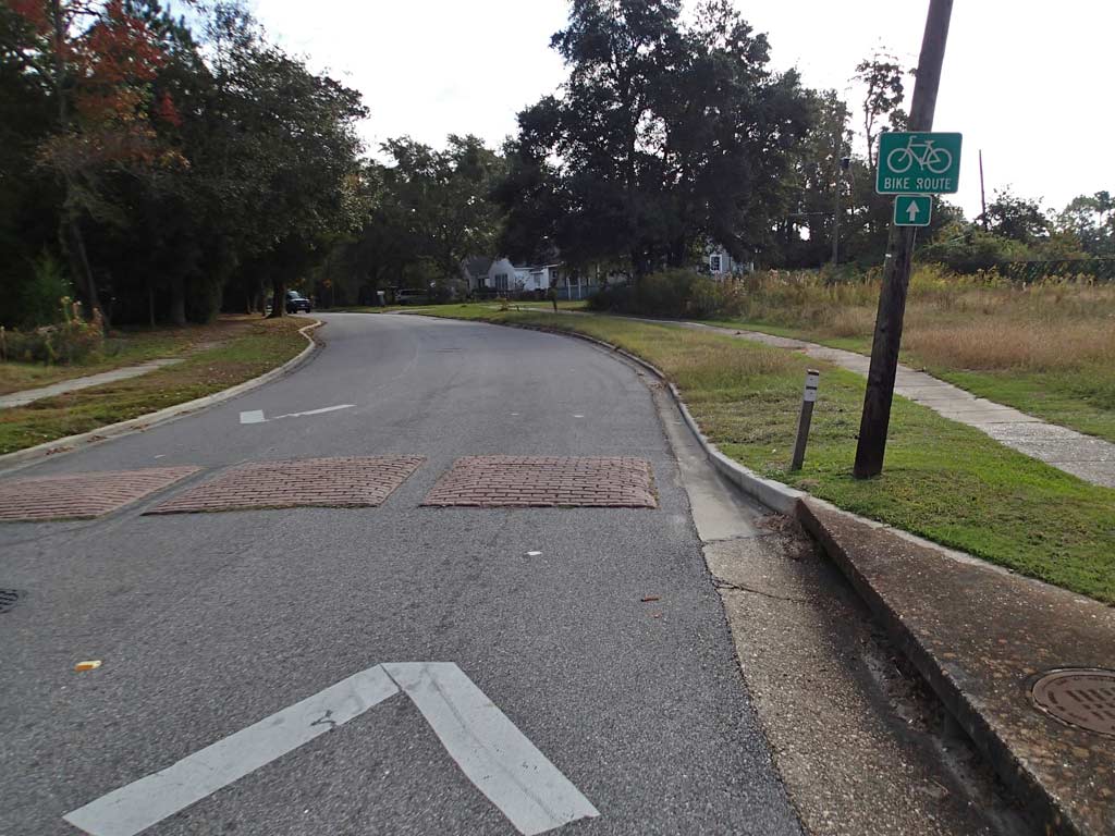
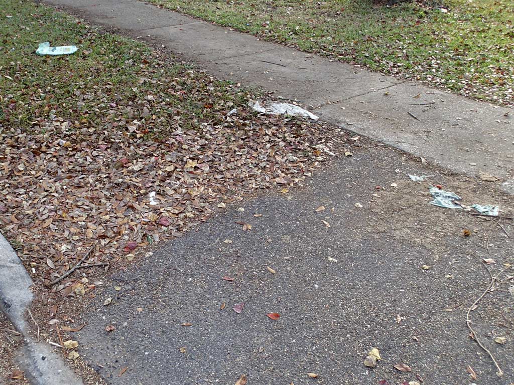
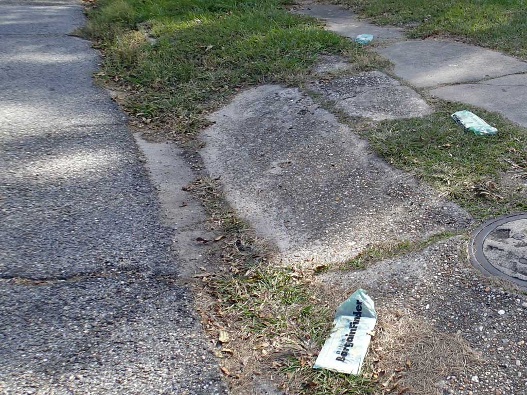
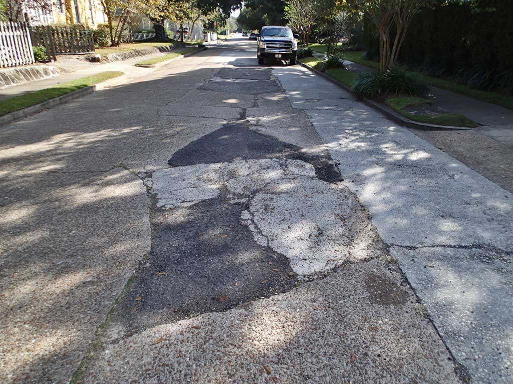
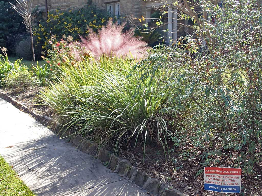
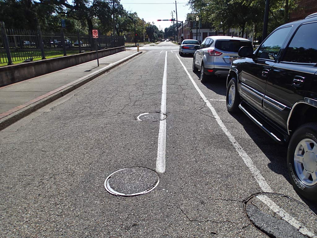
Cons: There are about 109 intersections along the 8 mile route meaning you'll have to watch for traffic on average every 388 feet which means frequently. Route signage is incomplete along the trail so out of town visitors are likely to get lost. There is no real destination to the bike route. Anyone following the mapped (see above PDF) route is going to end up bicycling the wrong way down a one way street either on St. Michael Street or Conti Street. There is no bicycle route marking on the pavement - only signs indicating "Bike Route." In one instance, the bike route sign points in two different directions. A few turns are missing signs. Some of roads along the route are full of patches and quite bumpy. Some of the concrete cracks are wide enough for a narrow tire bicycle to get caught in the crack. Plenty of litter was seen along the route. Some weaving away from the edge of the roads is necessary to avoid shrubs growing well out into the street.
Viewpoint: I rate this bicycle route as low as possible because the bicyclist must ride in the same narrow lane with the cars. Simply put, the downtown bicycle route is not bicycle friendly with the exception of there being low traffic volume which is typical of most neighborhood streets. But, if you happen to ride the route when the schools are getting out, that low volume changes into a non-stop stream of cars speeding down the middle of the street which happened to me today as the non-stop Westlawn Elementary School traffic went ballistic down Ralston Road. The bicycle route has no sensible starting point on Ralston Road nor at the end in Downtown Mobile. When the route gets downtown it meanders around and the route crosses itself a couple of times. Visitors attempting to ride the route based on current signs will get lost. But, for the people who live downtown who want to get on their bicycle and cruise around leisurely for a few miles in the downtown neighborhoods, this designated bicycle route is a safer alternative compared to riding on Dauphin Street or Government Street.
The downloadable GPS track of the Mobile Designated Downtown Bicycle Route can be found here:
http://www.everytrail.com/trip/editpictures?trip_id=2395138
Click on any thumbnail below to bring up a larger view photo gallery with commentary.
http://www.mobileunited.org/images/trails/Downtown.pdf
8.0 miles long.
Unmarked Narrow Asphalt and Concrete Roads
Rating: 1 (out of 10)
109 road/driveway crossings (1-Way). On average that is about 13 intersections per mile which is high.
4 People encountered (Both Ways). On average that means encountering 1 person along the trail for every 3 miles traveled which is very very low, but to be expected because the trail is basically neighborhood streets.
Pros: The route follows mostly low traffic downtown neighborhood roads. There are bathrooms along the trail like at the Library, Arby's, Fort Conde and Bienville Square. The bike route grade is flat. Parking can be found near both ends of the bike route at Springdale Mall and Fort Conde. The scenery varies from shotgun houses to nice well maintained mansions. There is a nice oak tree to see on Caroline Avenue.
Cons: There are about 109 intersections along the 8 mile route meaning you'll have to watch for traffic on average every 388 feet which means frequently. Route signage is incomplete along the trail so out of town visitors are likely to get lost. There is no real destination to the bike route. Anyone following the mapped (see above PDF) route is going to end up bicycling the wrong way down a one way street either on St. Michael Street or Conti Street. There is no bicycle route marking on the pavement - only signs indicating "Bike Route." In one instance, the bike route sign points in two different directions. A few turns are missing signs. Some of roads along the route are full of patches and quite bumpy. Some of the concrete cracks are wide enough for a narrow tire bicycle to get caught in the crack. Plenty of litter was seen along the route. Some weaving away from the edge of the roads is necessary to avoid shrubs growing well out into the street.
Viewpoint: I rate this bicycle route as low as possible because the bicyclist must ride in the same narrow lane with the cars. Simply put, the downtown bicycle route is not bicycle friendly with the exception of there being low traffic volume which is typical of most neighborhood streets. But, if you happen to ride the route when the schools are getting out, that low volume changes into a non-stop stream of cars speeding down the middle of the street which happened to me today as the non-stop Westlawn Elementary School traffic went ballistic down Ralston Road. The bicycle route has no sensible starting point on Ralston Road nor at the end in Downtown Mobile. When the route gets downtown it meanders around and the route crosses itself a couple of times. Visitors attempting to ride the route based on current signs will get lost. But, for the people who live downtown who want to get on their bicycle and cruise around leisurely for a few miles in the downtown neighborhoods, this designated bicycle route is a safer alternative compared to riding on Dauphin Street or Government Street.
The downloadable GPS track of the Mobile Designated Downtown Bicycle Route can be found here:
http://www.everytrail.com/trip/editpictures?trip_id=2395138
Click on any thumbnail below to bring up a larger view photo gallery with commentary.


 RSS Feed
