Allegheny Highlands Trail
Cumberland, MD (Elevation 605) to the Continental Divide in PA (Elevation 2392).
27 Miles (54 Miles Round Trip).
1787 Foot Climb from Cumberland over 24-25 Miles.
Railroad Grade (1.6%) - Easy Climb.
Worst Grade: About 5-6% (Sidetrip into Frostburg).
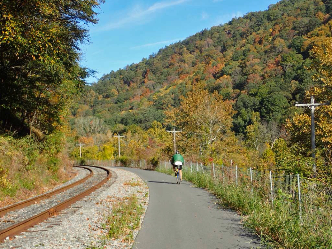
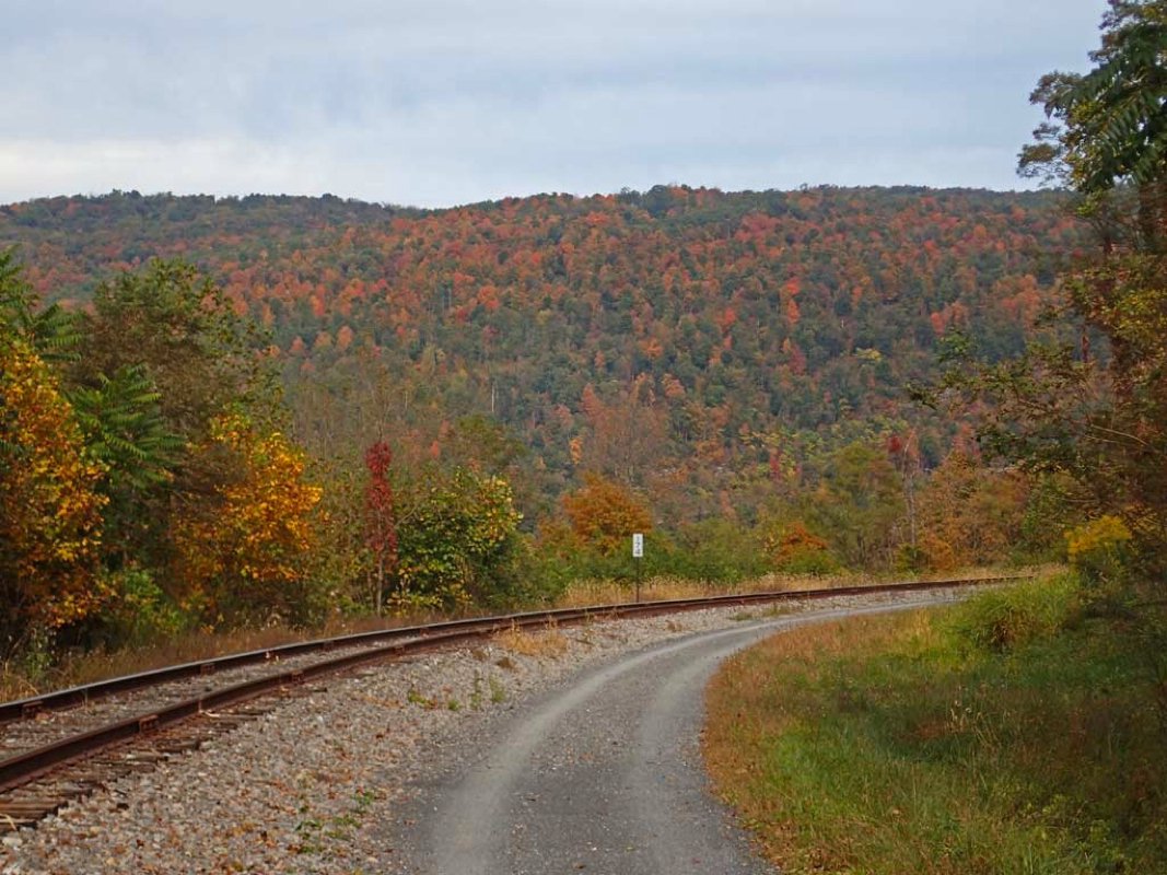
Trail follows an existing Railroad to Frostburg.
Number of intersections: About 7.
Number of people passed on the trail: 213.
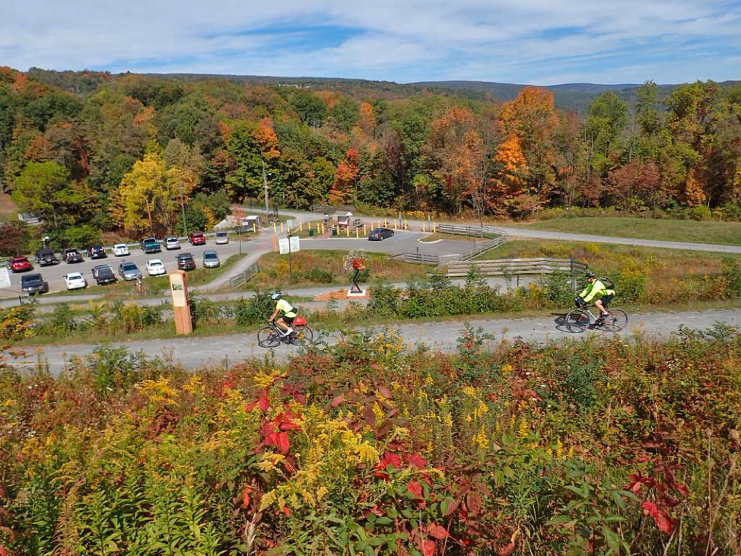
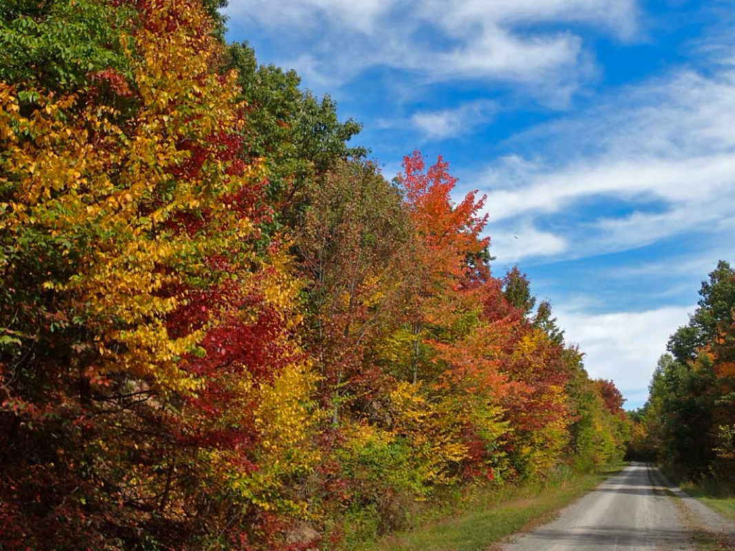
Pros: Standard trail amenities - shelters, bathrooms, picnic tables including some not so standard, like bicycle lockers in Cumberland. That means you can safely lock up your bike and gear and freely explore the town by foot without worry about your gear. Bike shop on the trail in Cumberland has rentals. Due to the trail being next to an existing railroad, the tree canopy was very open meaning more sun and open views of the surrounding mountains. Lodging was available along the trail in both Cumberland and Frostburg. First 4 or so miles of trail was paved asphalt, the remainder was a wide, very smooth cinder/dirt trail. No surface roots or big rocks to jar your butt bones. The only bad road crossing had a signal for cyclists to press to alert drivers to your crossing.
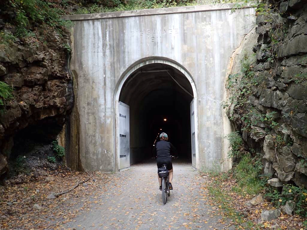
Cons: The 24 mile climb may be an issue for some but the long railroad grade hill was a real easy uphill ride for me. There is one long 3300 foot tunnel on the trip but it has lighting. In case the power goes out, you better have some good lighting with you in the Big Savage Tunnel.
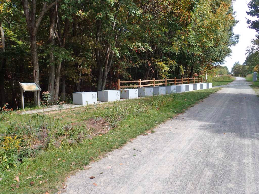
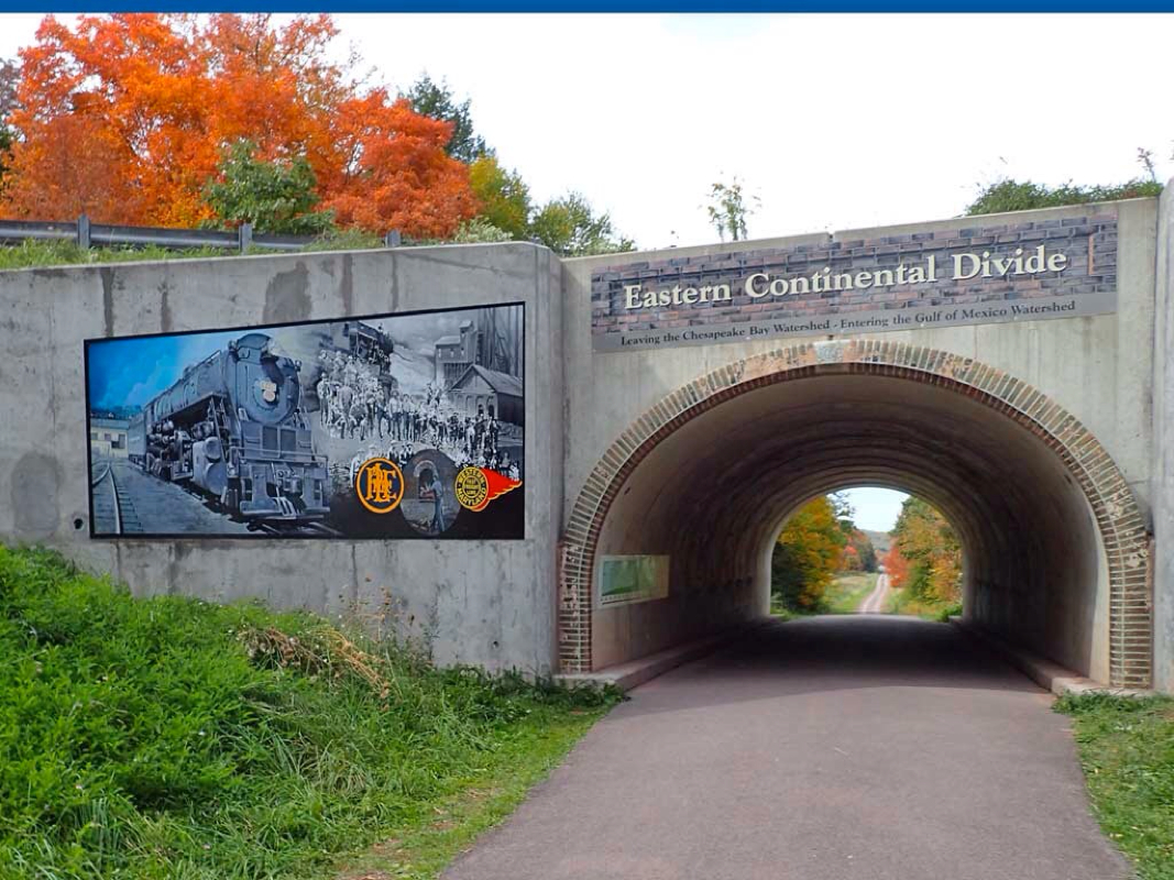
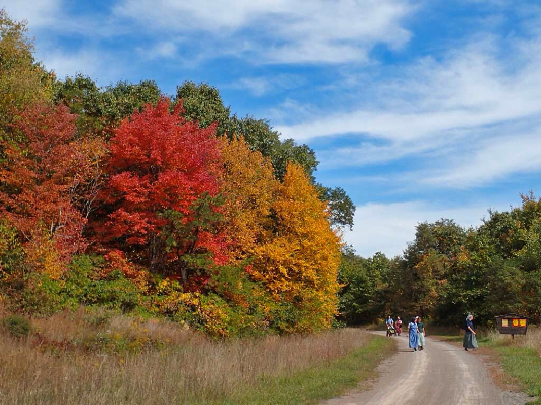
Hindsight: I had no idea the Allegheny Highlands trail continued on in Pennsylvania going all the way to Pittsburg and that there were a ton of other trails near Pittsburg. Just across the PA border where I thought the trail ended, the Big Savage Tunnel, the Mason Dixon Line and the Continental Divide were all unexpected surprises as well as seeing several Amish or Mennonite families hiking and picnicking on the trail. Had I known about the Great Allegheny Passage (GAP) trail I might have planned this trip as a one-way camping or motel trip along the entire trail from Pittsburg, PA to Washington, DC. I scoffed at the 15 mph trail speed limit knowing the return trip is all downhill. On the return trip, the scenery and foliage was so beautiful that I never bothered to pedal to get up to the speed limit. All I did was coast downhill at 10-12 mph for literally 2 full hours back to Cumberland wishing the trip would never end. This ride was spectacular.
Ratings: (1-5 scale, 5 being best)
Trail: 5 (All very smooth tiny cinder/packed clay.)
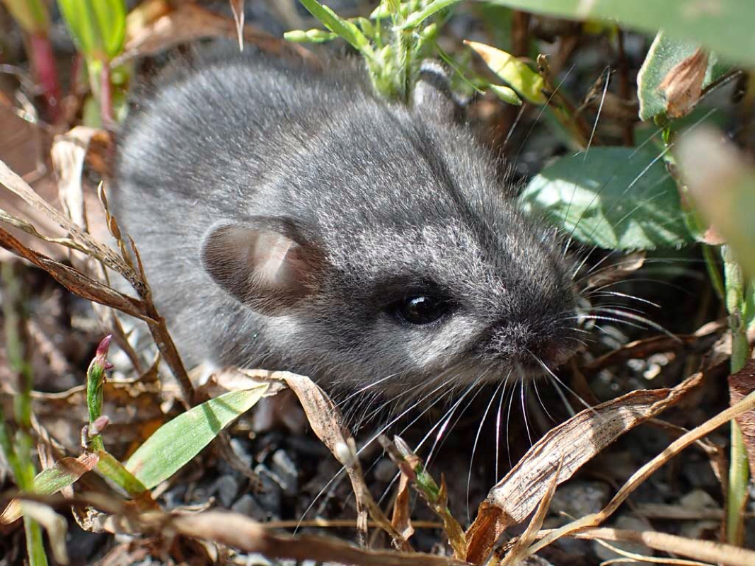
Critters: 2 (Saw a snake and a mouse.)
Scenery: 5 (Lots of awesome scenery and foliage.)
 RSS Feed
