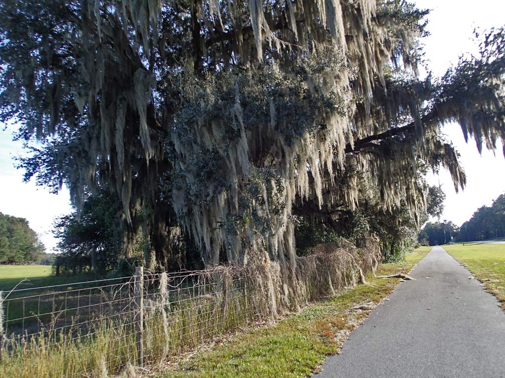
Spanish Moss (Not Spanish and Not a Moss) is an epiphyte that lives on nutrients and water gathered from the air.
Four Freedoms Trail (FL)
Map: http://www.madisoncountyfl.com/showFile.aspx?FileUploadID=1001817&PostID=3423
12.4 miles (8-10 feet wide asphalt)
(92% Bike Trail, 6% Bike Lane, 2% unmarked Road)
Rating: 3 (out of 10)
72 Road/Driveway Crossings (1-way) (About 6 crossings per mile which is quite a few)
7 People Encountered (Both Ways) (About one person every 3 miles which is very low. Not a single bicycler was seen and I can understand why).
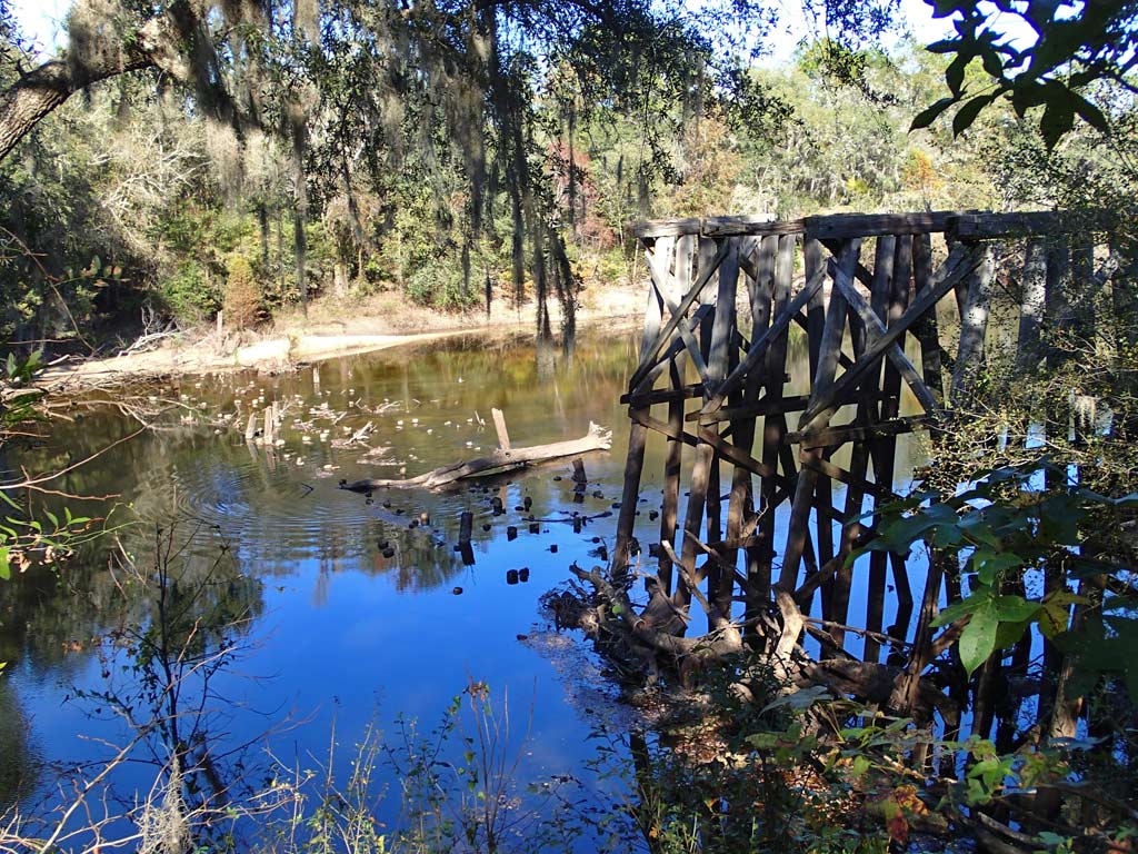
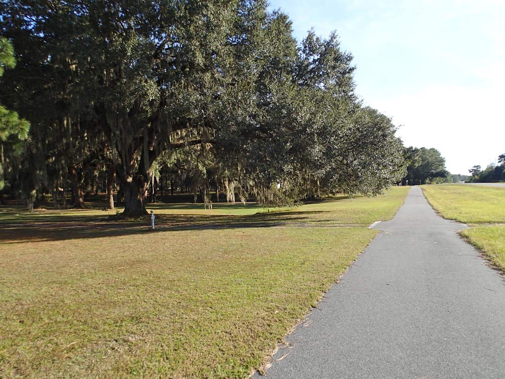
Pros: There were no car barrier posts in the middle of the trail to dodge. No six inch high curbs to go over. Parking was available at a few intersections. The scenery was varied from dense walls of trees to wide open farming pastures with the trail ending at the beautiful Withlacoochee River. The worst hill is about an 80 foot climb over a mile and a half which is an easy to ride 1% railroad grade.
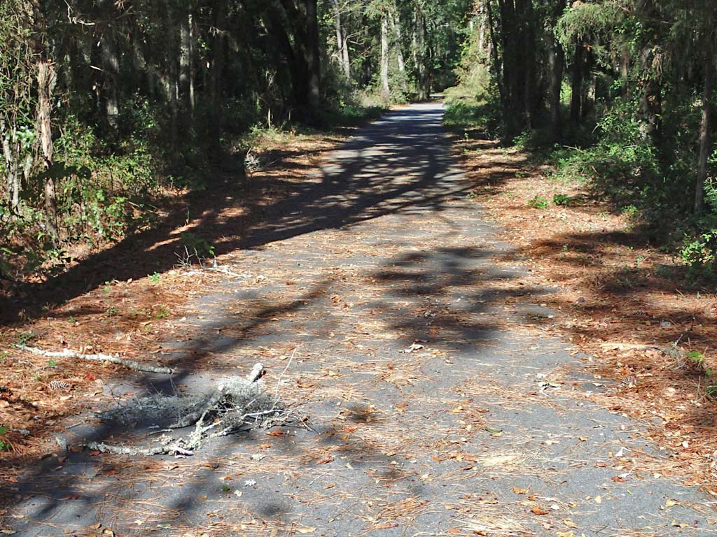
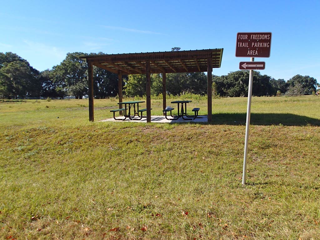
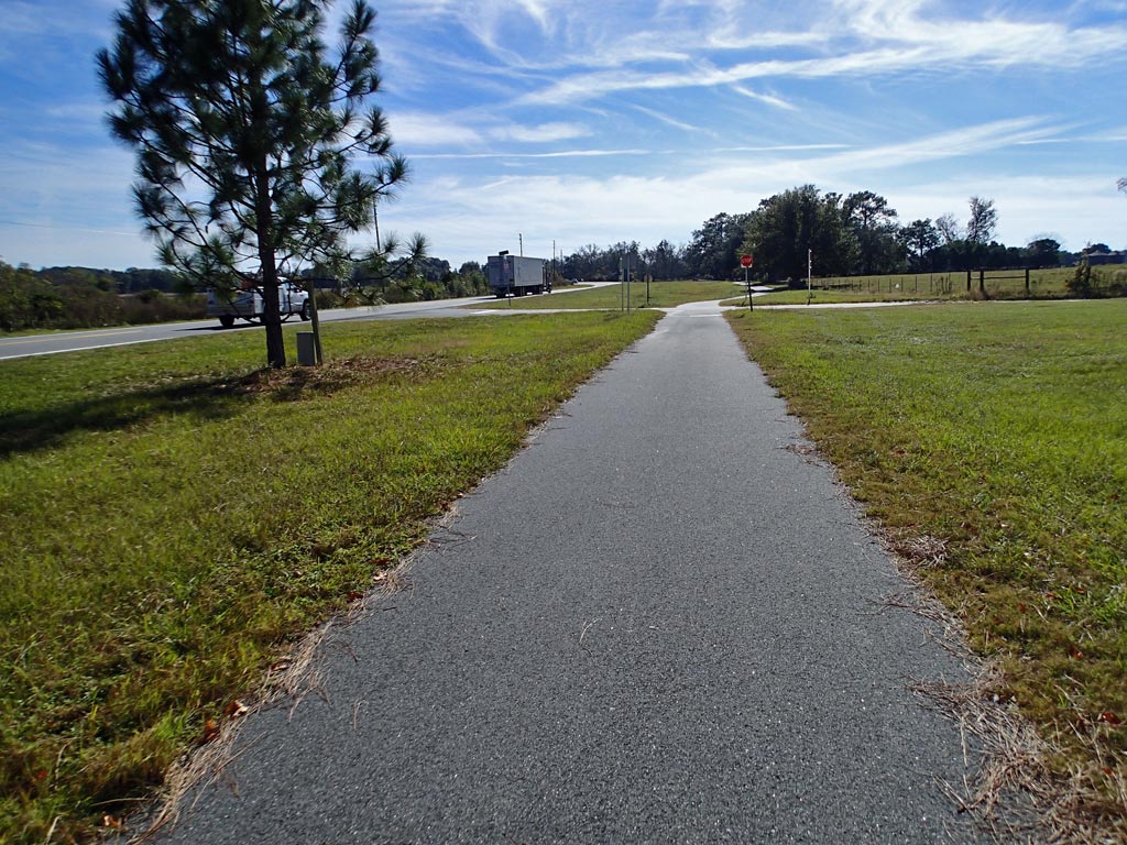
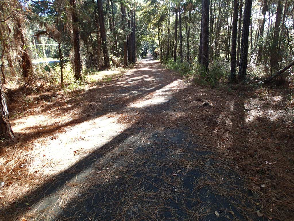
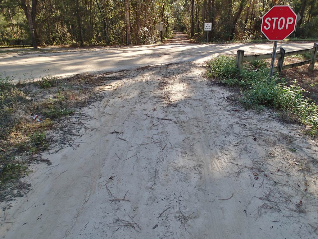
Cons: No restrooms. Really? No Bike shop. Dog chases. Four Freedoms Trail follows the busy Colin Kelly Hwy (Cr-145) 73% of the trail so think noisy truck traffic because of 18 wheelers. No maps seen on the trail. No security or maintenance people seen. Trail did not look like it had been swept in a month as it was littered with limbs and debris causing need to weave. At times the pine straw was so thick the asphalt was not visible. Unfortunately, many times it was under the blanket of thick pine straw where the asphalt was lifted by roots meaning the body got an abrupt jolt before ever seeing what root bump did it. Surface rooting in quite a few locations made this a miserable ride. There were mile markers visible going to the north but the numbers made no sense. No mile markers were visible on the return trip. The trail went through some people's front yards closer to their house than the street making the ride feel a bit awkward. What few garbage cans there were at picnic tables were overflowing. One picnic area had no garbage can and a bag of trash was left on the picnic table. Some of the road crossing markings were very faded. There was some grass growing in the midde of the asphalt. I could barely maintain control through two sandy areas on a Mountain Bike. The Four Freedoms trail changes from trail to bike lane and back several times. In the town of Pinetta the trail disappears in a two block area so you're left riding unmarked streets not sure which way to go.
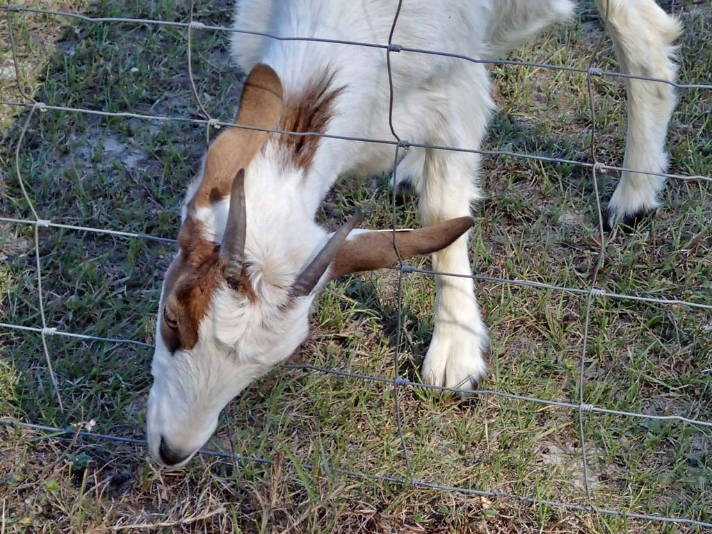
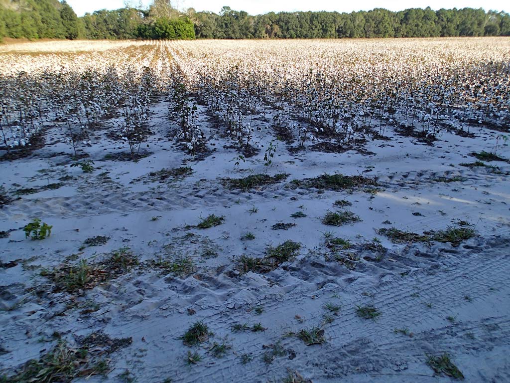
Viewpoint: In a nutshell, no, I would never plan to ride this trail again, even if in the area with a bicycle. This was one trail ride that had me thinking the sooner I get off the trail the happier I'll be. Couldn't wait for this bike ride to be over. Never saw a single bicycle rider during the 25 mile round trip ride which had me wondering how safe the trail was. Got chased by a dog. Rode through someone's trashy back yard where chickens were running around wild. Went through an area with a horrible chemical smell only to see cotton fields nearby which were probably sprayed with some chemical. For the locals, the trail is probably a good place to ride, walk and picnic safely away from vehicles. But for visitors like me, riding Four Freedoms Trail was not worth the time.
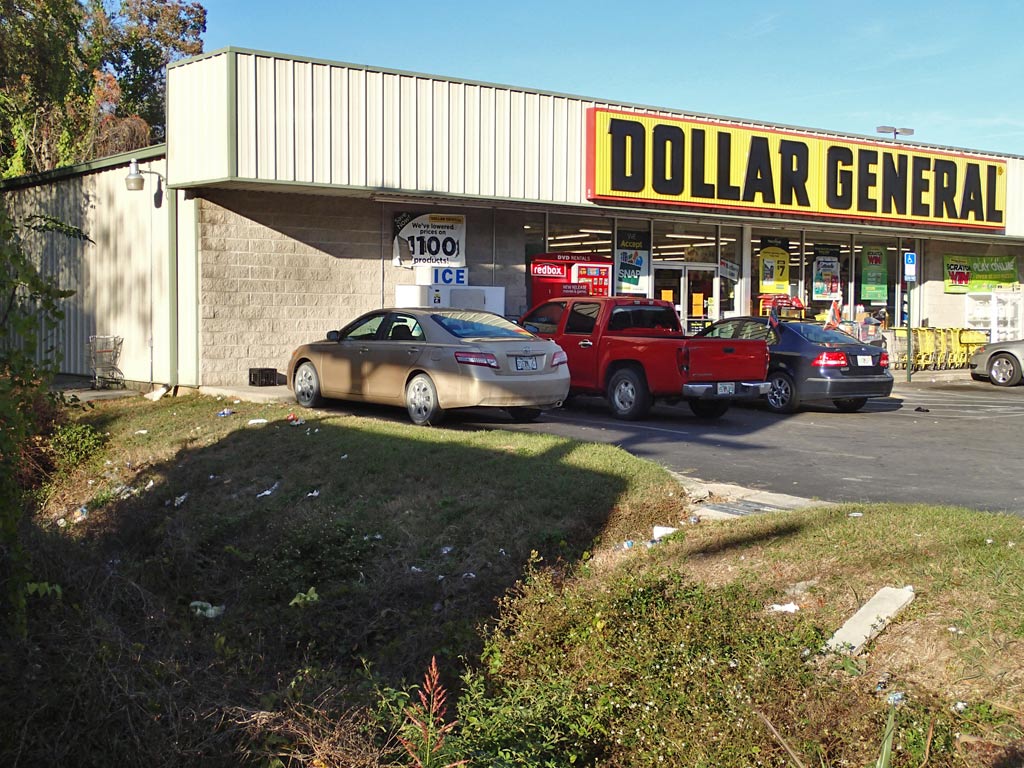
Tips: There is no trailhead parking at the either end of the trail so I parked in a shopping center next to the trashy Dollar General store a quarter mile south of the start of the trail. If you are wondering what the Four Freedoms are, on January 6, 1941 President Roosevelt said in a speech that the Four Freedoms are: Freedom of Speech and Expression, Freedom of Worship, Freedom from Want, and Freedom from Fear Everywhere In The World.
The downloadable GPS track of the Four Freedoms Trail can be found here:
http://www.everytrail.com/view_trip.php?trip_id=2454376
Click on any thumbnail below to bring up a larger view photo gallery with commentary.
Map: http://www.madisoncountyfl.com/showFile.aspx?FileUploadID=1001817&PostID=3423
12.4 miles (8-10 feet wide asphalt)
(92% Bike Trail, 6% Bike Lane, 2% unmarked Road)
Rating: 3 (out of 10)
72 Road/Driveway Crossings (1-way) (About 6 crossings per mile which is quite a few)
7 People Encountered (Both Ways) (About one person every 3 miles which is very low. Not a single bicycler was seen and I can understand why).
Pros: There were no car barrier posts in the middle of the trail to dodge. No six inch high curbs to go over. Parking was available at a few intersections. The scenery was varied from dense walls of trees to wide open farming pastures with the trail ending at the beautiful Withlacoochee River. The worst hill is about an 80 foot climb over a mile and a half which is an easy to ride 1% railroad grade.
Cons: No restrooms. Really? No Bike shop. Dog chases. Four Freedoms Trail follows the busy Colin Kelly Hwy (Cr-145) 73% of the trail so think noisy truck traffic because of 18 wheelers. No maps seen on the trail. No security or maintenance people seen. Trail did not look like it had been swept in a month as it was littered with limbs and debris causing need to weave. At times the pine straw was so thick the asphalt was not visible. Unfortunately, many times it was under the blanket of thick pine straw where the asphalt was lifted by roots meaning the body got an abrupt jolt before ever seeing what root bump did it. Surface rooting in quite a few locations made this a miserable ride. There were mile markers visible going to the north but the numbers made no sense. No mile markers were visible on the return trip. The trail went through some people's front yards closer to their house than the street making the ride feel a bit awkward. What few garbage cans there were at picnic tables were overflowing. One picnic area had no garbage can and a bag of trash was left on the picnic table. Some of the road crossing markings were very faded. There was some grass growing in the midde of the asphalt. I could barely maintain control through two sandy areas on a Mountain Bike. The Four Freedoms trail changes from trail to bike lane and back several times. In the town of Pinetta the trail disappears in a two block area so you're left riding unmarked streets not sure which way to go.
Viewpoint: In a nutshell, no, I would never plan to ride this trail again, even if in the area with a bicycle. This was one trail ride that had me thinking the sooner I get off the trail the happier I'll be. Couldn't wait for this bike ride to be over. Never saw a single bicycle rider during the 25 mile round trip ride which had me wondering how safe the trail was. Got chased by a dog. Rode through someone's trashy back yard where chickens were running around wild. Went through an area with a horrible chemical smell only to see cotton fields nearby which were probably sprayed with some chemical. For the locals, the trail is probably a good place to ride, walk and picnic safely away from vehicles. But for visitors like me, riding Four Freedoms Trail was not worth the time.
Tips: There is no trailhead parking at the either end of the trail so I parked in a shopping center next to the trashy Dollar General store a quarter mile south of the start of the trail. If you are wondering what the Four Freedoms are, on January 6, 1941 President Roosevelt said in a speech that the Four Freedoms are: Freedom of Speech and Expression, Freedom of Worship, Freedom from Want, and Freedom from Fear Everywhere In The World.
The downloadable GPS track of the Four Freedoms Trail can be found here:
http://www.everytrail.com/view_trip.php?trip_id=2454376
Click on any thumbnail below to bring up a larger view photo gallery with commentary.


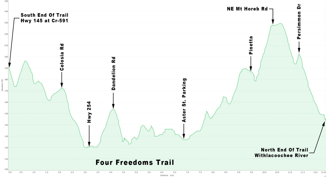
Profile of the Four Freedoms Trail that has flat railroad grade hills meaning easy to ride.
 RSS Feed
